


With drought, heat waves, high fire danger, drains on the electrical grid and the general ramping-up of climate change, the urban East Bay’s open space brings worry along with relief.
Worry for all the above. Relief for the easy access to so many natural areas for hiking, biking, running, birdwatching, picnicking or simply escaping the din of city living.
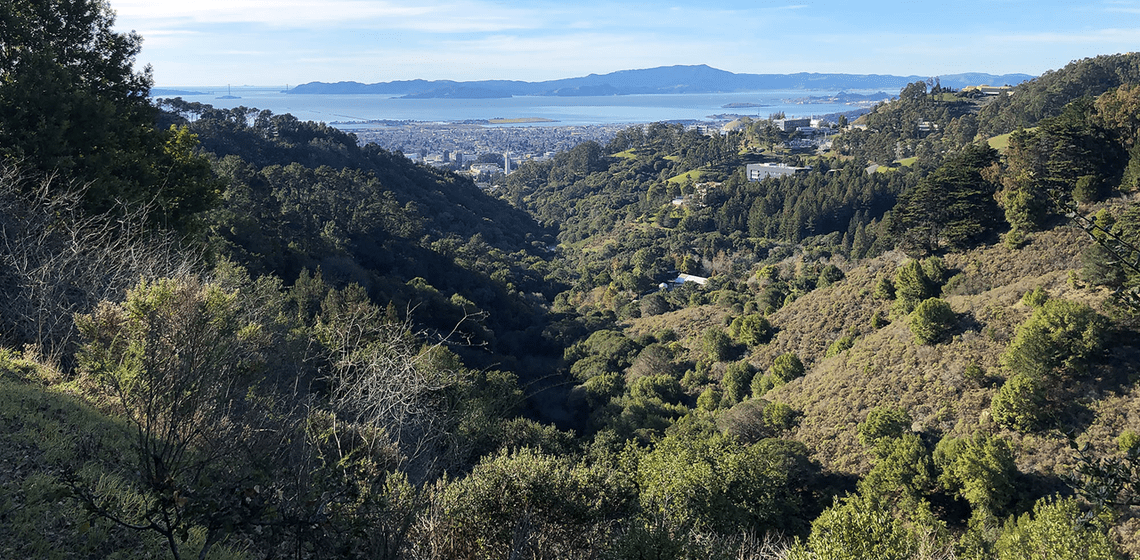
More than 200,000 acres of undeveloped land borders Berkeley, Oakland and neighboring East Bay cities, mostly to the east, from the Carquinez Strait to the South Bay. This includes around 125,000 acres of East Bay Regional Park District land (EBRPD) and 60,000 acres of EBMUD protected watershed. Still more if you include lands of UC Berkeley, PG&E, counties and cities.
Soon, we’ll know a lot more about our open space neighbors — both wildlife and vegetation. About their ecological health and their vulnerability to wildfire.
Three major East Bay land studies are underway or recently completed under collaborations of public land managers including EBRPD, EBMUD, Alameda and Contra Costa counties and Berkeley and other local cities.
They include:
- A wildlife survey, already completed, covering lands of EBRPD and EBMUD.
- A fine-scale vegetation map, showing 3-D images covering all of Alameda and Contra Costa counties. Completion is likely in a few years.
- A related wildfire risk map, based on vegetation, and topography, also covering all of Alameda and Contra Costa counties. Completion is likely in mid 2023.
The hope, say experts leading the work, is to produce comprehensive, state-of-the-art tools to help with land use decisions.
They also point out that Alameda and Contra Costa counties are latecomers to much of this work, with fine-scale mapping already completed for many Bay Area counties, including Sonoma, Marin, San Mateo, Santa Clara and Santa Cruz.
“We’re a big missing piece for the Bay Area,” said Dina Robertson, wildland vegetation manager for EBRPD, which is the lead agency for the mapping projects. “I am very interested in looking at the entire park district, all of our lands and wildlands, to figure out a way to tackle land resilience. What is the best way to manage our lands?”
East Bay critters are generally in ‘fair condition’; caution warned for what lies ahead


The first assessment out the gate is NatureCheck, released in April, a deep-dive at the ecological health of East Bay wildlife, from bats to bobcats and salamanders to steelhead. The review, which will be updated periodically, was spearheaded by a group of public land managers called the East Bay Stewardship Network.
In addition to EBRPD and EBMUD, the network includes the California State Parks (CSP), Contra Costa Water District (CCWD) and San Francisco Public Utilities Commission (SFPUC).
The network members’ contiguous or joined lands give the analysis regional significance, and also make it a first of its kind for the East Bay.


“A science-based snapshot, this report looks at the condition and trend of select wildlife species deemed to be good indicators of the region’s ecological health and for which we either have or are in the process of collecting data,” says NatureCheck’s executive summary.
Read the full NatureCheck report
Based on mostly existing 2009-20 data, “[The] project establishes a baseline against which we can use the quantitative metrics developed for each indicator to measure change over time,” the summary says.
It purposefully captures a relatively recent analysis of wildlife, rather than historical, with the aim of setting a benchmark for the future. “We intentionally chose to establish this ecological baseline on existing conditions inclusive of modern anthropogenic stressors [human-caused pollution or effects] rather than use historical conditions to which we cannot realistically expect to return,” the report said.
Focusing on indicator species or types of wildlife that are a good gauge of overall ecosystem health, the assessment analyzes population trends over the data period. It includes a discussion of stressors to habitat, such as climate change, development, disease, and invasive species, and identifies data gaps.
Because of the breadth of land it covers, the assessment offers comparisons between micro or subregional areas. It generally divided lands into three subregions: the East Bay hills, closest to Berkeley; the Mt. Diablo Range; and Mt. Hamilton, near San Jose. Aquatic life centered on distinct watersheds or ponds and lakes. Birds were analyzed across wider areas.
The focus is primarily on open space east of cities on the San Francisco Bay , and not along shorelines.
The overall findings, said Becky Tuden, an ecological services manager for the EBRPD who oversaw the assessment for the district: “Grade C.”
“We’re only in fair condition,” Tuden said. “It’s passing.”
In general, the NatureCheck found that many wildlife species are currently stable, including bats, bobcats, foxes and pumas. Amphibians such as the red-legged frog and California tiger salamander are also stable.
However, grassland birds and the Golden Eagle are experiencing high adult mortality. And while populations of tiger salamander are stable, they’re in decline. Native fish populations such as rainbow trout are steady, but showing struggle.
Some wildlife populations are stable in some subregions, but declining in other areas, indicating concern. Some populations are stable but their habitat is threatened.
“Caution” is a label appearing often in the report to describe the condition of species.
“Nobody wanted to give [the findings] a bad grade, and no one wanted to say, ‘It’s great.’
It’s a fine line to walk,” Tuden said.
The analysis, which is funded by the Regional Parks Foundation and Marathon Petroleum, doesn’t make recommendations, and is primarily intended as a resource for landowners, managers, policymakers and the public — though it discusses threats to East Bay wildlife such as development, human activity, climate change, disease and invasive species.
“At this point we’re just informing people,” Tuden said.
She added: “Do we want our ecology to be just passing? I leave that up to other people. My personal opinion is we should be doing a much better job than we are.”
The assessment acknowledges that “ecological health can be hard to pin down, given that constant change can be brought about by factors that are largely beyond our control, such as climate change, wildfire, and disease.”
It boils down health to three components:
- Ecosystems are resilient (able to function/recover despite change or shock)
- The full complement of plants, animals, and other life is present and able to find food, shelter, and water, and to reproduce
- Natural processes occur in a manner and frequency considered “normal” based on best available science
The assessment noted that the East Bay fine-scale vegetation map currently in the works should offer valuable details that will be folded into NatureCheck.
The health of wildlife is intrinsically connected to the health of habitat – plants, water and air. “The vegetation affects animals and vice versa … If you start going out of balance you’re going to lose things, and gain other things you might not want,” Tuden said.
The recent year of extreme drought wasn’t within the data collection period, but the aim is to capture this with updates, Tuden said.
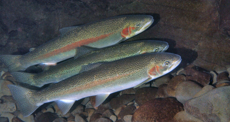
In a closer look at Wildcat Creek, which runs through Tilden Park, the assessment analyzed native and non-native fish populations — specifically rainbow trout also known as steelhead, a vulnerable indicator species of overall creek health.

For overall native fish, the watershed received a “caution.” While most fish in the creek are native, more than one species of nonnative fish were consistently found, indicating an “impaired” watershed, the report said.
Rainbow trout received a grade of “significant concern,” with the report noting that while the trout were found in the creek during all years of the data collection, the effects of the state’s extended drought are expected to wallop its habitat.


You may see golden eagles soaring over the hills above the creek, though this would be rare, as it has been for the 10-year assessment period. The analysis found stable populations. Further east around Mt. Diablo and south around Mt. Hamilton, however, where golden eagles are more common, data shows a decline in young birds reaching adulthood, leading to an overall condition of “caution.”
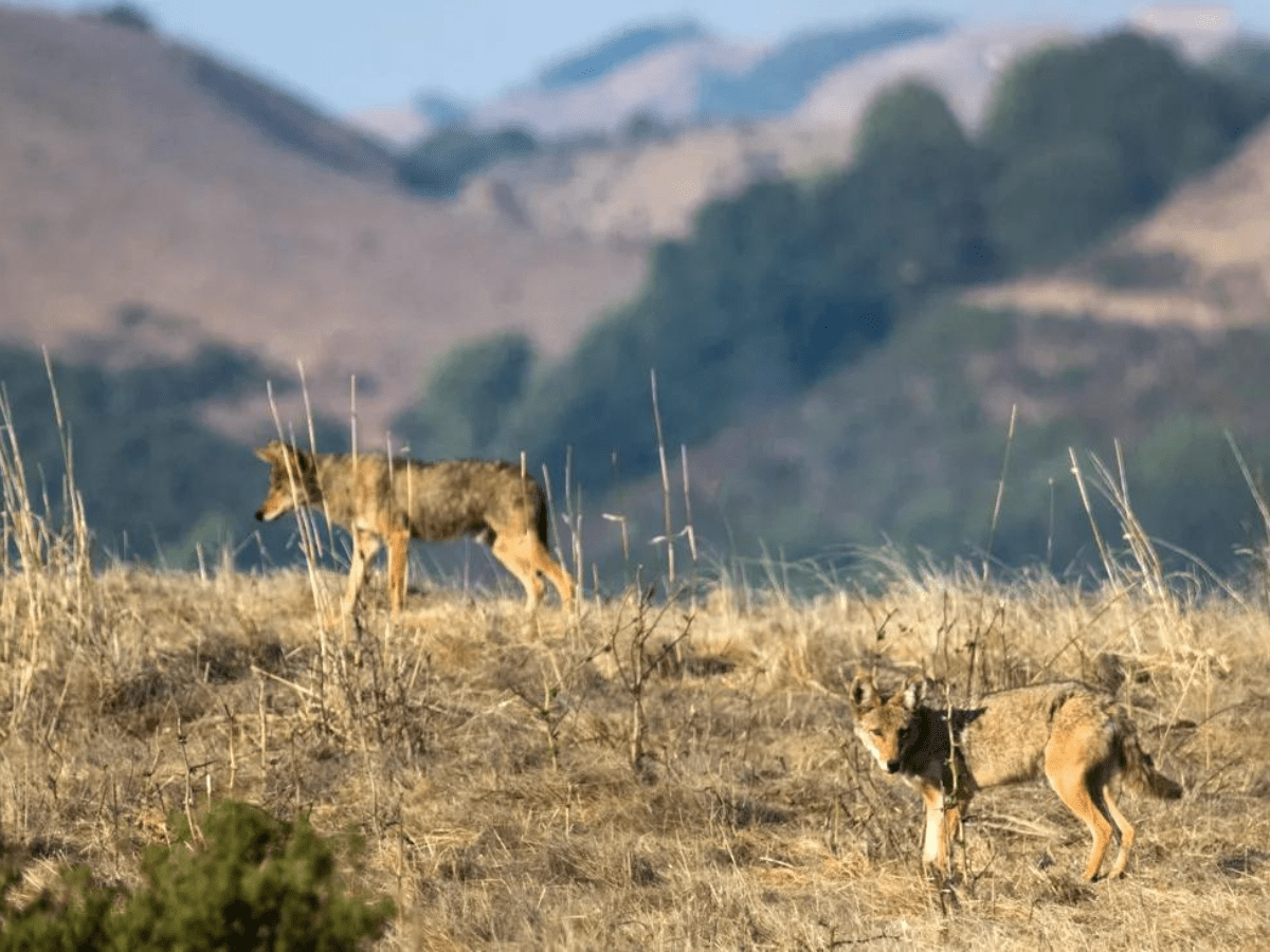
As for mesocarnivores (majority meat-eaters) that dip down to the creek for water, bobcat, coyote, and gray fox populations in the East Bay hills appear stable, though longer term data is needed to get a take on breeding patterns. Rare species known to traipse the East Bay hills such as the badger, long-tail weasel, and ringtail might be getting more rare, with the subregion getting a mesocarnivore “caution.”
Read the report for details on the Wildcat Canyon area’s wildlife of the land and sky.
A deep look at plants will guide decisions around preservation, development, habitat restoration and wildfire mitigation

Filling in gaps in NatureCheck, and much more, is a fine-scale vegetation survey, currently underway. Using state-of-the-art spatial analysis techniques such as LIDAR, a type of aerial imaging, and GIS or satellite imaging, along with computer modeling and some field observations, this project will map vegetation down to half-acre or one-acre segments.
“The products produced will help to complete a detailed wildland fuel and vegetation information base for all Bay Area counties,” said Dina Robertson, EBRPD wildland vegetation program manager working on the project.
Robertson, and consultant Kass Green, described the process:
“First, map makers go to the field with the imagery on iPads to sample the landscape and understand what causes variation in vegetation type. Next, the samples are dropped through a myriad of datasets known to be correlated with vegetation type such as slope, aspect, distance to streams, vegetation height, etc., and machine learning is used to establish relationships between the variables and vegetation type. Finally, the maps are manually edited to correct for errors in the machine learning algorithms.”
Funded largely by a grant from the California Department of Fish and Wildlife, with other contributions, the project includes all of Contra Costa and Alameda counties, both private and public land. The EBRPD is overseeing the project.
“It’s super cool,” Robertson said. “It’s not just the park district, it’s every piece of land private and public. [The results] will all be available to the public on a server.”
San Mateo and Marin are two counties with completed fine-scale vegetation mapping, which provide a good sense of the East Bay’s project.
The maps should help decision making around preservation, development, habitat restoration, and wildfire mitigation, Robertson said.
“Anticipated applications for the project products are many, including watershed and flood management; climate change adaptation; wetland restoration; wildfire planning, prioritization and response; open space acquisition prioritization, wildlife management, and restoring the health of the numerous degraded East Bay forests, grasslands, and natural lands to enhance ecological resilience and reduce fire risk to communities,” said Robertson and Green.
Vegetation survey will yield detailed wildfire risk maps
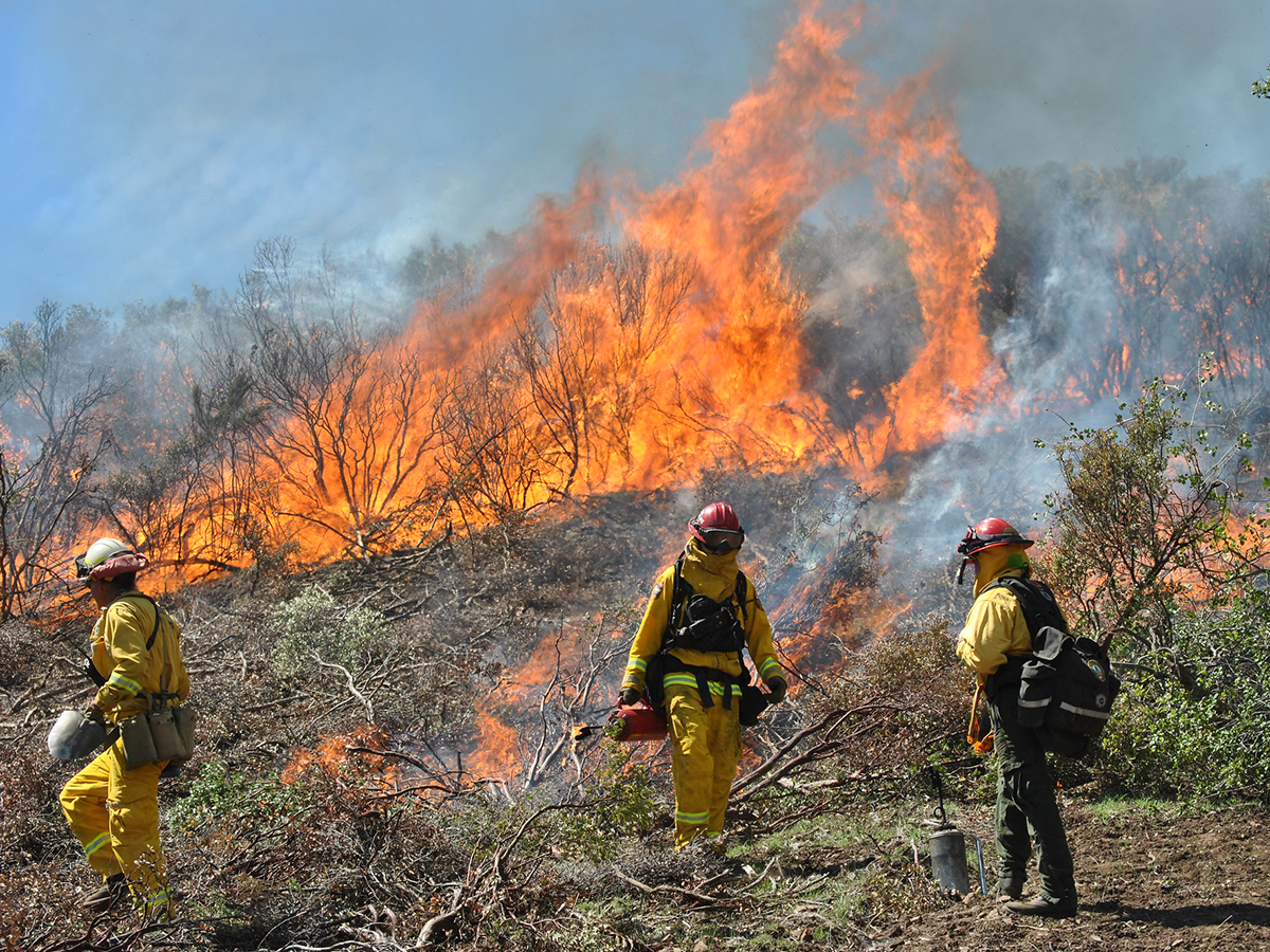
Perhaps one of the most keenly anticipated tools in the mapping pipeline is the wildfire risk assessment, which is one layer or application of the fine-scale vegetation project.
The goal is to complete the wildfire risk map by the end of 2023.
“The wildfire risk maps and associated data sets will support communities and land owners in prioritization and planning of evacuation routes and wildfire risk reduction activities. The data set will be consistent with similar data sets developed for most of the Bay Area,” Robertson and Green said.
The maps will be available to the public on a website such as this one.
Fire risk mapping will also have its own dedicated portal such as this one for Sonoma County.
One of the biggest obstacles to large-scale assessments is funding, Robertson said. At the same time, the availability of this kind of data helps with future spending decisions by providing fact-based information.
With dead and dying trees; shrinking creeks, lakes and ponds; shrinking wildlife habitat, sea level rise; and a public eager for a diversity of recreational and urban escape opportunities, competition for land management dollars is fierce.
“It’s all about prioritization,” Robertson said. “Where are we going to spend our time? We need to make sure we’re tackling the highest priorities. … looking at entire landscapes and prioritizing.”